In 1923, geologist J. Harlen Bretz suggested that the striking canyons and buttes in Eastern Washington were formed in just days by a massive flood, not over long periods as was widely believed. His peers dismissed him as a quack, arguing that geological changes take thousands of years, making the idea of such rapid formation impossible. Dry Falls, located in Eastern Washington, was once the largest waterfall in the world, significantly larger than Niagara Falls.
Bretz faced ridicule for more than ten years for his so-called “crazy” theory, but he turned out to be correct. The Channeled Scablands in the area were indeed shaped by floodwaters. He dedicated years to fieldwork, carefully mapping the region’s distinct landscape. Bretz observed features like channels instead of valleys and significant erosive changes that others could not see without visiting the site. However, he struggled to identify the source of the floodwaters.
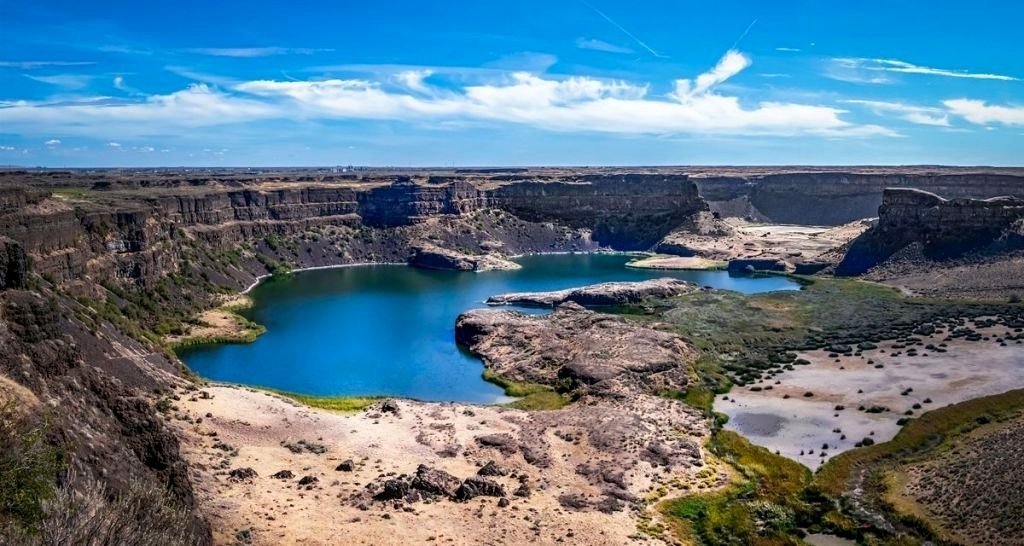
While many people picture Washington as a place filled with evergreen trees, mountains, and rain, Eastern Washington presents a different image. This region is mostly dry, sunny, and covered with sagebrush, unlike the lush environments often associated with the state. Despite its arid nature, Washington has a variety of stunning landscapes.
Bretz found the geography of Eastern Washington intriguing. Each summer, he took students to explore its deep basalt canyons, ripples in the bedrock, large coulees, and unusual geological features that went unnoticed by other scientists. He named this area the Channeled Scablands, highlighting the land’s scars from a significant disaster. His careful observations led him to believe that a colossal flood had shaped the terrain, but it took another geologist, Joseph Pardee, to establish the source of the flood: Glacial Lake Missoula in Montana.
Glacial Lake Missoula was massive, comparable to the combined size of Lake Erie and Lake Ontario. It formed when the Clark Fork River created a blockage behind a towering ice dam. Near the end of the last Ice Age, this dam broke, releasing the lake’s water rapidly. The National Park Service describes the event as a surge of water, hundreds of feet high, rushing downstream at a speed of 65 miles per hour. This flood carried ten times the volume of water found in all of today’s rivers, impacting a vast area of about 16,000 square miles across Montana, Idaho, Washington, and Oregon.
The sudden release of such a large volume of water would have been catastrophic. For those living in the vicinity 15,000 to 18,000 years ago, this would have been a terrifying experience. Initially, Bretz thought that one single flood created the landscape, but he later realized that Lake Missoula experienced multiple floods over time.
When Bretz introduced his flood theory, many geologists were committed to the idea of uniformitarianism, which suggests that geological formations develop slowly over millions of years. His view, which focused on the possibility of significant, rapid changes due to catastrophic events, was largely rejected as unscientific. Bretz became isolated from the geological community, which preferred to adhere to long-term gradual change rather than his theory that resembled biblical events.
What do you think about Bretz’s theory and its acceptance in the scientific community?
Sources:
Source: Upworthy, by Annie Reneau